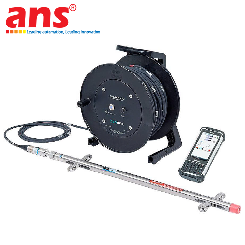
GEOKON GK-604-8 SiteMaster Inclinometer Data Reduction Software
Price: Contact
Brand: Geokon Vietnam
Category: Thiết bị quan trắc
Supplier: AnhNghiSon
Origin: USA


 0911472255
The GEOKON GK-604-8 SiteMaster (Model Code: GK-604-8 / SiteMaster Inclinometer Data Reduction Software) is a comprehensive geotechnical data reduction, analysis, and reporting program provided by GEOKON (USA) with 100% USA Origin. Purpose-built for geotechnical engineers, it manages borehole databases, performs complex mathematical reductions on raw survey data, and generates publication-grade deflection plots for deep foundation, slope stability, and structural safety monitoring.
*DELIVERY NOTE:*
Product Code GK-604-8 is an Electronic Software License (NOT SHIPPED). The software download link and digital license key are delivered electronically to the customer's designated email address (Please specify recipient email upon ordering).
KEY SOFTWARE FEATURES AND OPERATIONAL ADVANTAGES:
1. Automated Data Import & Multi-Format Compatibility:
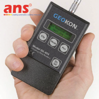
• Directly imports raw survey files generated by GEOKON digital and analog inclinometer systems (GK-604, GK-604D with Model 6100D probes and Field PC).
• Seamlessly accepts data files from diverse international formats: standard ASCII raw text (.txt, .dat), comma-separated values (.csv), DigiPro files (.gkn, .dgp), and other commercial inclinometer readouts.
2. Advanced Mathematical Reductions & Error Corrections:
• Computes cumulative displacement, incremental deflection, and absolute profile deviations across depth for both orthogonal axes (A and B).
• Evaluates checksum data (A+/A- and B+/B-) to identify survey irregularities, depth indexing errors, or sensor anomalies.
• Features integrated Casing Spiral Correction using survey logs from the GEOKON Model 6000-20 Spiral Probe, realigning deflection profiles to true geographical or structural headings.
• Applies bias-shift corrections and systematic probe drift compensation to ensure maximum data integrity over multi-year monitoring campaigns.
3. High-Resolution Vector Graphing & Customization:
• Generates depth vs. cumulative displacement plots, incremental displacement plots, checksum profiles, time vs. displacement graphs, and vector displacement trajectories.
• Offers complete control over plot aesthetics, scale limits, axis labels, site stratigraphy layering, excavation benchmarks, and groundwater elevation overlays.
4. Hierarchical Project Database Tree:
Organizes hundreds of inclinometer casings and boreholes within a centralized project tree. Enables cross-comparison between adjacent boreholes along critical structural cross-sections.
5. One-Click Report Generation & Export Flexibility:
Generates comprehensive client-ready engineering reports with single-click ease. Exports reports directly to high-quality PDF files, formatted Microsoft Excel spreadsheets, or high-resolution graphic images.
TYPICAL GEOTECHNICAL APPLICATIONS:
• Processing and presenting lateral deflection data for diaphragm walls, secant pile walls, and soldier piles in deep excavations.
• Tracking shear plane movements and slope stability in natural embankments, highway cuts, and open-pit mining operations.
• Monitoring subsurface deformation and settlement across embankment dams, tunnels, and deep foundation bridge abutments.
• Manufacturer: GEOKON
• Software Title: SiteMaster Inclinometer Data Reduction Software
• Product Code (Model): GK-604-8
• Brand Origin: USA (100% USA Origin)
• Product Classification: Technical Geotechnical Software License
• Delivery Method: Electronic Software Delivery via Email / Download (NOT SHIPPED)
• Order Requirement: Valid customer email address must be specified for software download and license key generation
• Compatible Operating Systems: Microsoft Windows 10 / Windows 11 (32-bit & 64-bit), Windows 8, Windows 7
• Minimum Hardware Requirements:
- Processor: 1 GHz or faster processor
- System RAM: 2 GB minimum (4 GB or higher recommended)
- Hard Drive Storage: 500 MB free space for application installation and database files
- Display: 1024 x 768 minimum screen resolution (Full HD 1920 x 1080 recommended)
• Compatible Hardware & Input Sources:
- GEOKON GK-604D Digital Inclinometer System (Model 6100D Probe, Field PC)
- GEOKON GK-604 Analog Inclinometer System (Model 6000 Probe)
- GEOKON Model 6000-20 Inclinometer Spiral Probe
- Other industry-standard digital and analog inclinometer probes
• Supported Import File Formats:
- GEOKON raw survey files (.gkn, .dat, .txt)
- Comma-delimited spreadsheets (.csv), Microsoft Excel (.xls, .xlsx)
- DigiPro file format (.dgp)
- User-configured custom column ASCII text files
• Analytical & Reduction Functions:
- Cumulative Displacement calculation (A and B axes)
- Incremental Displacement calculation (A and B axes)
- Checksum validation and error analysis
- Casing Spiral Error Correction (incorporating spiral survey datasets)
- Bias-Shift and baseline adjustment correction
- Systematic probe error compensation
• Graphical Output Types:
- Depth vs. Cumulative Displacement plots
- Depth vs. Incremental Displacement plots
- Depth vs. Checksum plots
- Time vs. Displacement progression curves
- Horizontal Displacement Vector plots
• Export Output Capabilities: Multi-page PDF geotechnical reports, Microsoft Excel spreadsheets, and high-resolution raster images (PNG, JPG, BMP)